Carved by millions of years of geological forces and shaped by centuries of Vietnamese civilization, Tam Coc hides stories as deep as its cave passages. Beneath its emerald rice paddies and towering karst peaks lies a landscape that has witnessed emperors, invasions, and the quiet endurance of a people intimately tied to the land.
The story of Tam Coc begins not with human hands but with the slow, immense power of geology. Approximately 250 to 300 million years ago, the region that is now Ninh Binh province lay beneath a shallow tropical sea. Over vast stretches of time, the accumulated shells and skeletal remains of marine organisms compressed into thick limestone beds. As tectonic forces gradually lifted the land, rainwater — slightly acidic from dissolved carbon dioxide — began dissolving the rock over tens of millions of years, carving the dramatic karst towers, caverns, and subterranean river channels that define the Tam Coc landscape visitors marvel at today.
The Ngo Dong River, which flows through the heart of Tam Coc, is the living result of this ancient dissolution process. Over millennia, the river carved three distinct cave tunnels through solid limestone mountains — Hang Ca, Hang Hai, and Hang Ba, meaning First, Second, and Third Cave respectively — giving the area its name: Tam Coc, or 'Three Caves' in Vietnamese. Early human communities recognized the strategic value of this labyrinthine landscape, with its natural fortifications and fertile floodplains, settling along the river's banks and cultivating rice in the shallow, mineral-rich paddies that still bloom golden each harvest season.

Tam Coc sits within the broader Trang An Landscape Complex, a region that served as the cradle of Vietnamese statehood. Just a few kilometers away lies Hoa Lu, the ancient capital of Vietnam from 968 to 1010 AD under the Dinh and Early Le dynasties. Emperor Dinh Tien Hoang, who unified twelve warring factions to establish the Dai Co Viet kingdom — Vietnam's first independent feudal state — chose this fortress-like terrain of karst peaks and winding waterways precisely because it was nearly impenetrable to invaders. The mountains served as natural walls, and the flooded valleys functioned as defensive moats protecting the imperial capital.
The region's military significance reached its zenith during Vietnam's resistance against Mongol invasions in the 13th century. General Tran Hung Dao used the karst landscape of Ninh Binh and the surrounding region as a strategic base during the three Mongol invasions of 1257, 1284, and 1288. The maze of limestone caves, hidden river passages, and dense vegetation allowed Vietnamese forces to conceal troops, supplies, and boats. This intimate knowledge of local terrain proved decisive in repelling one of the most formidable military forces in human history, and the landscape of Tam Coc became inseparable from the narrative of Vietnamese national identity and resistance.
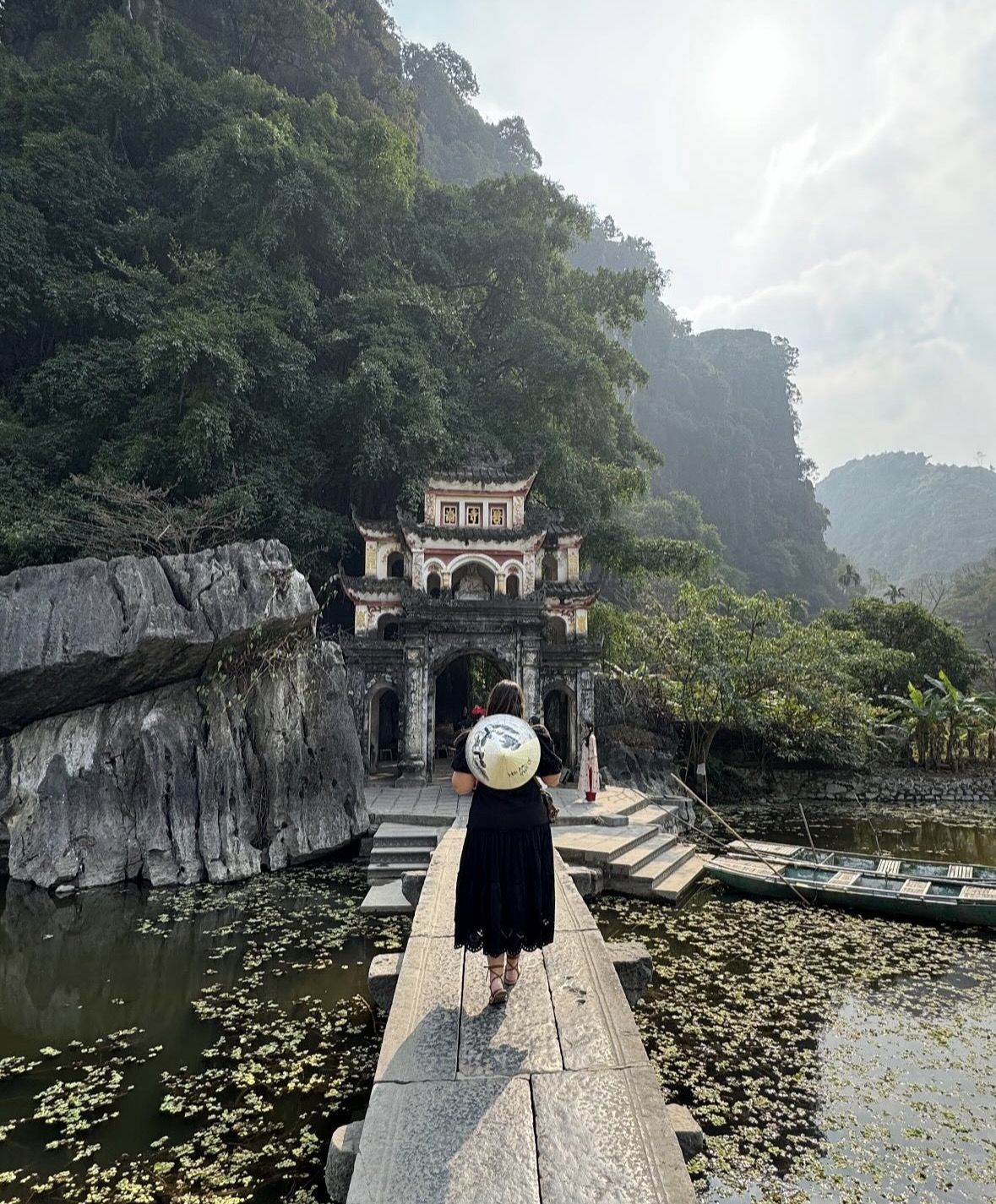
Beyond warfare, Tam Coc held profound spiritual significance for the Vietnamese people. Bich Dong Pagoda, carved into a limestone cliff face overlooking the Ngo Dong River, dates to 1428 during the reign of King Le Thai To of the Later Le dynasty. Constructed across three levels — Lower, Middle, and Upper Pagoda — it exemplifies the Vietnamese tradition of building sacred spaces within natural rock formations rather than imposing upon them. Buddhist monks and pilgrims traveled arduous routes to worship here for centuries, weaving religious devotion into the fabric of daily life along the river. The pagoda remains an active place of worship, connecting modern visitors to centuries of unbroken spiritual practice.

The international recognition of Tam Coc's extraordinary value came on June 23, 2014, when the Trang An Landscape Complex — encompassing Tam Coc, Bich Dong, Trang An Grottoes, and the Hoa Lu ancient capital — was inscribed on the UNESCO World Heritage List. Remarkably, it was awarded dual status as both a cultural and natural World Heritage Site, one of only a handful of locations worldwide to receive this distinction. UNESCO cited the region's outstanding geological formations, its rich biodiversity including rare primate species, and its layered human history spanning thousands of years as justification for this prestigious recognition that elevated Tam Coc onto the global tourism stage.
Tourism to Tam Coc began developing in earnest during the 1990s following Vietnam's Doi Moi economic reforms, which opened the country to foreign visitors. Early travelers arrived to find a landscape virtually unchanged from centuries past — local women rowing wooden sampan boats through cave tunnels using their feet to free their hands for harvesting river weeds. This unique rowing technique, a practical adaptation born from the specific demands of navigating low cave ceilings while managing cargo, became one of Tam Coc's most iconic images. The sight of rowers gliding silently through cathedral-like limestone passages, with rice paddies glowing on either side, drew increasing numbers of travelers seeking an alternative to Vietnam's coastal resorts.
The release of the 2019 American film 'Kong: Skull Island,' portions of which were filmed in Ninh Binh province, brought Tam Coc's dramatic landscape to a global cinema audience and triggered a significant surge in international visitor interest. Combined with the enduring popularity of Halong Bay — to which Tam Coc is frequently compared and often called 'Halong Bay on Land' — the region became one of Vietnam's fastest-growing tourism destinations through the late 2010s and early 2020s. Infrastructure investment followed, with improved road access from Hanoi, expanded boat launch facilities, and new eco-tourism trails developed to manage and enhance the visitor experience sustainably.
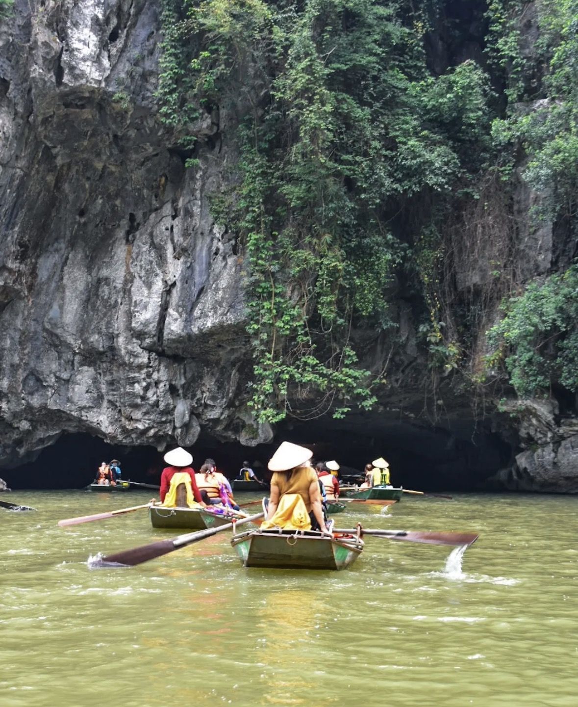
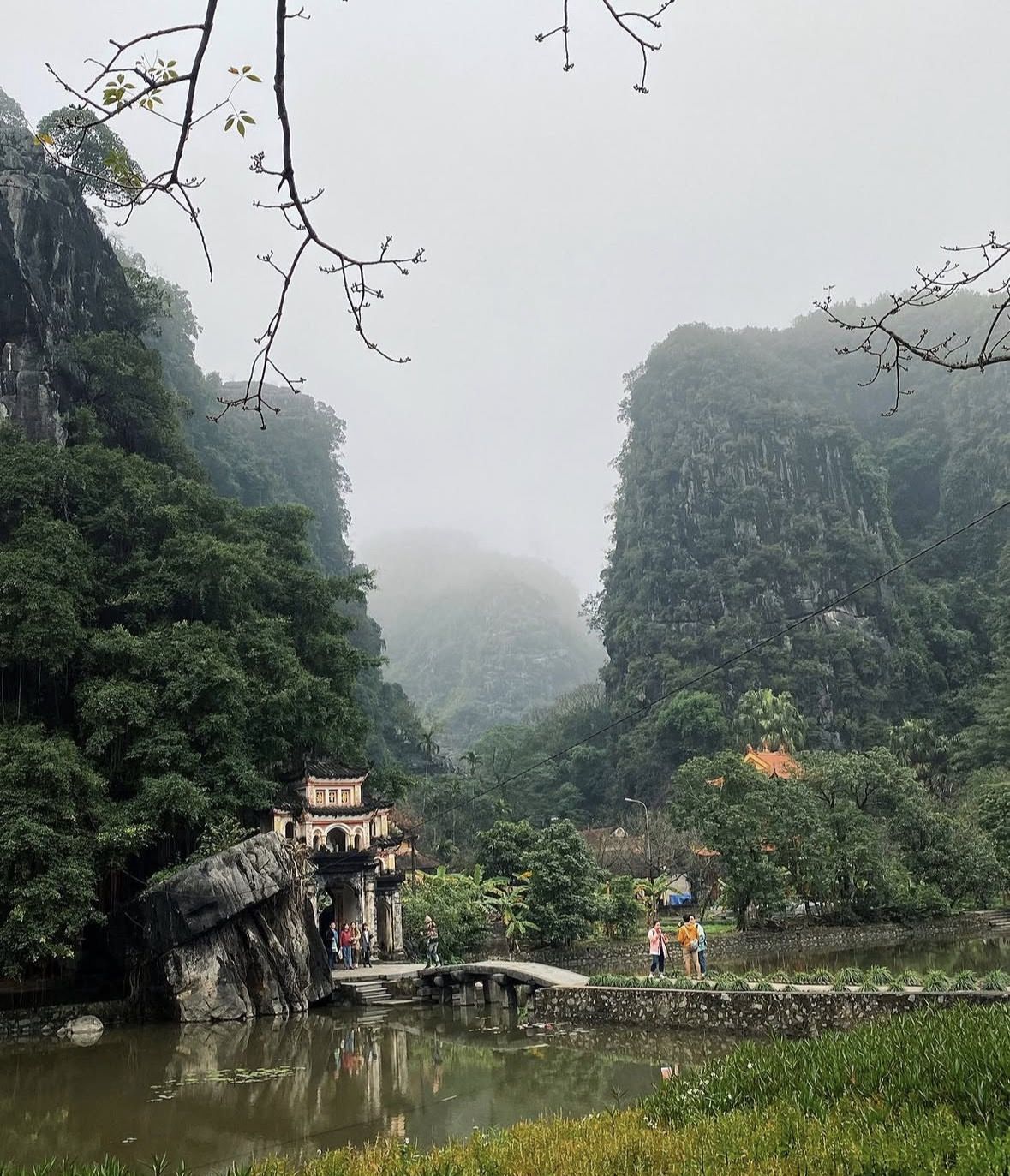
Today, Tam Coc functions as both a thriving tourism destination and a living community where traditional rice farming continues across the paddies flanking the Ngo Dong River. The approximately 2-kilometer boat journey through the three caves typically takes one to two hours, offering an unhurried, intimate encounter with limestone formations draped in ferns, nesting birds, and the play of light filtering through cave openings. Beyond the river, cycling trails connect Tam Coc to Bich Dong Pagoda, the ancient Hoa Lu temples, and the broader Trang An Grottoes, allowing visitors to construct multi-day itineraries that layer natural wonder with genuine cultural and historical depth rarely found in a single compact area.
The village of Van Lam, adjacent to the Tam Coc boat launch, is renowned for its hand-embroidered textiles — a craft tradition practiced by local women for generations and now an important source of supplementary income alongside farming and tourism. Seasonal changes transform the landscape dramatically: the brilliant gold of rice harvest in May and October draws photographers from around the world, while summer months fill the paddies with vivid green. Whether you arrive seeking the geological grandeur that took 300 million years to sculpt, the echoes of ancient Vietnamese kingdoms, or simply the transcendent peace of drifting silently beneath limestone mountains, Tam Coc offers an experience that rewards every kind of traveler.
Ready to Experience It Yourself?
From gliding through ancient cave tunnels on the Ngo Dong River to cycling past golden rice paddies toward thousand-year-old temples, Tam Coc delivers an unmissable chapter in any Vietnam journey. Our handpicked tours combine expert local guides, comfortable transport from Hanoi, and authentic cultural experiences that go far beyond the typical boat ride. Browse our Tam Coc tour options today and secure your place in one of Southeast Asia's most breathtaking UNESCO World Heritage landscapes.
Book Your Tour Now